

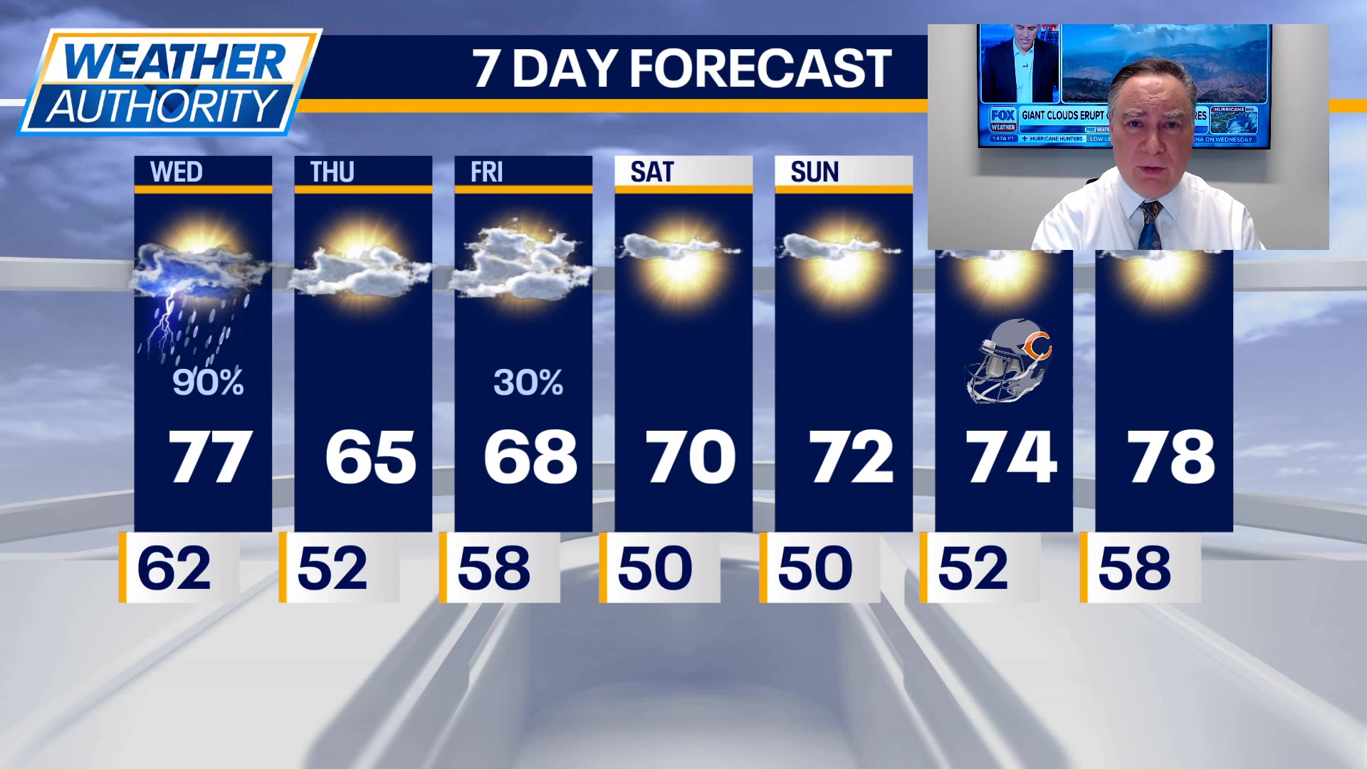
CHICAGO – Showers and storms in the Chicago area today will give way to cooler, sunny weather through the weekend with highs near 70°.
Chicago weather forecast
What to expect:
As of 3 a.m., there are a few showers over Northwest Illinois and southern Wisconsin. I expect those to weaken as they approach Chicagoland this morning.
A higher chance for widespread showers and a few rumbles of thunder will take place this afternoon into the early evening hours. Skies will be mostly cloudy in between with highs in the 70s, coolest north, warmest towards our southern area.
Tonight, skies will eventually clear out after midnight with low temperatures dropping into the upper 40s in some suburbs to lower 50s in town.
Future forecast
What’s next:
Tomorrow will be mostly sunny and much cooler with highs in the mid 60s. A reinforcing shot of cooler air will move in for Friday accompanied by some scattered light rain showers during the early morning hours, possibly lingering into the morning commute. Highs will be in the mid-to-upper 60s as skies clear during the afternoon.
The weekend looks positively splendiferous with highs on both days not far from 70°.
Monday will be a little bit warmer with highs in the low to mid 70s under mostly sunny skies. Perfect weather for the Bears-Vikings game at Soldier Field.
There are signs of at least a brief warm-up for a couple of days Tuesday and Wednesday.
The Source: The information in this report came from FOX 32 Meteorologist Mike Caplan.